
Global Mapper
"Spatial Distillery is an authorised provider of Global Mapper by Blue Marble Geographics in Australia and New Zealand. "
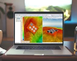
Global Mapper® is a cutting-edge GIS software that provides both novice and experienced geospatial professionals with a comprehensive array of spatial data processing tools, with access to an unparalleled variety of data formats.

A flexible, all-in-one GIS platform, Global Mapper offers powerful tools to help you visualise, analyse, and manage spatial data at any scale. It delivers value through practical features, local support, and wide format compatibility.
Global Mapper v26
Low-cost and easy-to-use GIS
Supports more than 300 spatial data formats
Optional LiDAR Module for powerful point cloud processing
Advanced projection management using GeoCalc library*
Unmatched technical support
Highlights
A powerful new function for creating a point cloud from a 3D model or mesh
A new free-flight visualization option in the 3D View providing a first-person game-like perspective when moving through the 3D environment
A new raster eyedropper tool for selecting a color for transparency assignment or vector extraction
Several new Map Layout tools including legend filtering and custom map book creation based on features selected on the map
Expanded touchscreen functionality with support for panning and zooming
Performance and processing improvements, especially when working with large vector files
A streamlined licensing process providing users access to their online account from within the software
LIDAR Module
A new tool for creating a 3D model surface from selected LiDAR points
Support for spatially thinning a LiDAR or point cloud layer
A new raster eyedropper tool for selecting a color for transparency assignment or vector extraction
A new option for extracting buildings from LiDAR as 3D models rather than 3D vector features
A new tool for gridding LiDAR Data by Classification

Global Mapper in Australia: Built for Local Projects
With flexibility for everyday mapping tasks and advanced spatial modelling, Global Mapper is used in Australian councils, engineering firms, planners, utility providers and environmental teams. From preparing floodplain overlays and managing infrastructure assets to working with geo AI, it helps you process large datasets, visualise scenarios and share results seamlessly.
Equipped with Powerful GIS Capabilities
Global Mapper is designed to handle large, complex spatial datasets without slowing down your workflow. It combines GIS functionality, terrain analysis, point cloud tools, and raster processing in one easy-to-use interface.
A smart fit for collaborative mapping, use the Global Mapper software on its own or integrate it with broader QGIS geocoding, cloud platforms and asset management systems. Whether you’re using it to automate repetitive tasks or model real-world scenarios, it gives you the tools you need to make fast, informed decisions.

Why Choose the Global Mapper Software?
Wide Format Compatibility: Global Mapper removes the need to convert files, import, edit and export in your preferred formats.
All-in-One Functionality: There’s no need for expensive add-ons. Get terrain tools, LiDAR analysis, vector editing, and raster calculations in one place.
Flexible Licensing: Available as a single-user license or a floating license across your team.
Adaptable Connectivity: Work in remote field locations or stream live data when connected, use Global Mapper in online and offline modes.
Automation-Ready: Speed up repeat tasks with scripting and batch tools.
Full Support: Backed by The Spatial Distillery Company with expert advice, local setup, and custom training.
Pair your Global Mapper software with our QGIS courses or bundle it with Maxar satellite imagery for enhanced mapping results.
Global Mapper FAQs
-
Global Mapper works both online and offline with their mobile model, making it a great fit for fieldwork. You can load data in advance and continue working without needing a live internet connection. Once you’re back online, simply sync or export your results. This flexibility is why users in environmental and infrastructure projects trust it on-site.
-
Yes. The software includes built-in scripting tools and batch processing to help automate repetitive tasks, ideal for high-volume data management or standardised analysis. Many users pair these tools with asset monitoring or planning workflows to boost productivity. We can also help configure automation as part of your broader GIS setup.
-
It supports over 300 raster, vector, and elevation data formats. That means you can open, edit, and export everything from shapefiles and GeoTIFFs to KML, DXF, DWG, and point cloud data – all without needing to convert first. This wide compatibility makes Global Mapper in Australia a go-to GIS tool for mixed-format workflows.

The Spatial Distillery Co.
We are Global Mapper experts with over 25 years experience in GIS & Location intelligence. We are your local experts to help your organisation get the most from your investment in Global Mapper. We provide costs effective software subscription options to keep costs down and productivity up.
We are here to help.
Offering access to an unparalleled variety of spatial datasets, Global mapper provides a high level of functionality to satisfy both the experienced GIS professionals and beginning users. Global mapper can be used as a standalone spatial data management tool or as an integral component of an enterprise-wide GIS.
Contact us to learn more or purchase.
Get Started with Global Mapper
We help organisations across Australia and New Zealand get up and running with Global Mapper software. The Spatial Distillery Company simplifies the process with one-off licences, ongoing training, or end-to-end support for integrating your tools into your spatial stack.
Contact us to explore how Global Mapper fits into your GIS solutions.