What’s Really Holding Location Intelligence Back? Four Barriers Organisations Need to Overcome
Last month, we asked our customers a simple question:
What’s the biggest barrier to better location intelligence in your organisation?
The response was striking.
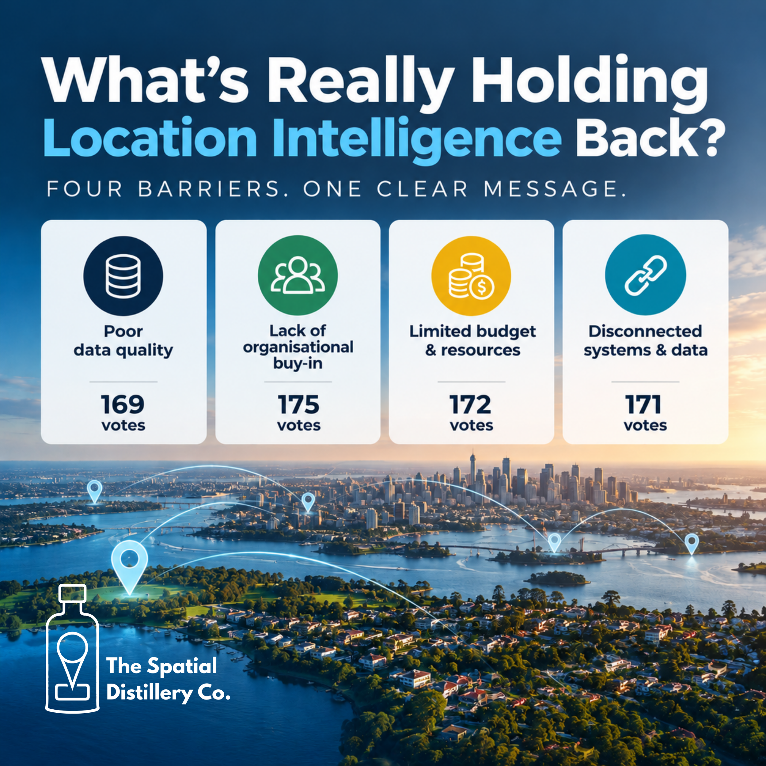
Rather than one issue emerging as the obvious problem, the results were almost perfectly split across four common challenges:
Lack of organisational buy-in: 175
Limited budget & resources: 172
Disconnected systems & data: 171
Poor data quality: 169
With 687 votes in total, the difference between first and fourth place was just six votes.
That tells us something important.
The challenge isn't one thing.
For many organisations, better location intelligence is being held back by a combination of data quality, organisational priorities, funding and disconnected technology.
And, importantly, these challenges are often interconnected.
Location intelligence is no longer just a GIS problem
Location intelligence has evolved significantly.
What was once largely the domain of GIS teams and specialist spatial analysts is now increasingly relevant to executives, planners, asset managers, operations teams, marketers, infrastructure managers and customer-facing teams.
Organisations are recognising that location provides a powerful context for understanding where things are happening, why they are happening there and what might happen next.
But having access to maps and spatial data doesn't automatically create location intelligence.
The real value comes from connecting location, data, technology and decision-making.
And that's where the barriers begin to appear.
1. Lack of organisational buy-in
With 175 votes, organisational buy-in was the most selected barrier — although only marginally.
This is perhaps the most interesting result.
Because location intelligence can deliver significant value, why is organisational buy-in still such a challenge?
One reason is that spatial technology can sometimes be perceived as a technical capability rather than an organisational capability.
A GIS team might understand exactly what can be achieved with spatial data, but that doesn't necessarily mean the wider organisation understands its strategic value.
The conversation needs to move from:
“We have GIS.”
to:
“We use location intelligence to make better decisions.”
That distinction matters.
When spatial information is connected to business objectives — improving service delivery, managing assets, understanding customers, planning infrastructure, identifying risk or allocating resources — the value becomes much easier to communicate.
The opportunity
Location intelligence needs to be positioned around business outcomes, not simply software, maps or datasets.
The question shouldn't be:
“What can our GIS do?”
It should be:
“Which decisions could we make better if we understood the location dimension?”
2. Limited budget and resources
Only three votes separated organisational buy-in from limited budget & resources, which received 172 votes.
This is unsurprising.
Even organisations that understand the value of location intelligence still need to find the people, technology and funding to make it happen.
There can be significant costs associated with:
acquiring and maintaining spatial data
GIS and location intelligence platforms
cloud infrastructure
data integration
specialist spatial expertise
training and capability development
maintaining data quality
developing applications and dashboards
But budget isn't always the only constraint.
Capacity is often just as important.
A GIS team may already be responsible for maintaining critical datasets, supporting users, responding to requests and delivering operational projects.
That leaves little time to investigate new technologies or develop strategic location intelligence capabilities.
The opportunity
Organisations don't necessarily need to build everything themselves.
A combination of internal capability, managed services, specialist partners, automation and cloud-based platforms can help organisations access sophisticated location intelligence without having to maintain every capability in-house.
The goal should be to focus scarce resources on the areas where spatial expertise creates the greatest value.
3. Disconnected systems and data
171 respondents identified disconnected systems and data as their biggest barrier.
This is one of the fundamental challenges facing modern organisations.
Most organisations already have enormous amounts of data.
The problem is that it often lives in different places.
CRM systems.
Asset management platforms.
ERP systems.
Property databases.
Planning systems.
Customer databases.
IoT platforms.
GIS.
Satellite and aerial imagery.
Open data.
Operational spreadsheets.
And increasingly, AI systems.
Each system may work perfectly well on its own.
But the real value often appears when they can be connected through a common geographic framework.
Location can provide that connection.
A property, address, road, asset, business, parcel or infrastructure network can become the common thread linking information across multiple systems.
This is one of the reasons location intelligence is increasingly becoming an integration capability rather than simply a mapping capability.
The opportunity
Organisations should be asking:
“Can we connect our important data through location?”
If the answer is no, improving the underlying spatial architecture may deliver more value than simply purchasing another visualisation tool.
4. Poor data quality
169 votes identified poor data quality as the biggest barrier.
Although it came fourth in the poll, it was effectively tied with everything else.
And there is a good reason for that.
Location intelligence is only as good as the location data behind it.
If addresses are inaccurate, assets are incorrectly located, boundaries are outdated or datasets are maintained inconsistently, the analysis built on top of them becomes less reliable.
This becomes particularly important when organisations start using spatial data for automation and AI.
An inaccurate dataset doesn't simply produce an inaccurate map.
It can produce an inaccurate decision.
### The opportunity
Data quality needs to be treated as an ongoing capability rather than a one-off cleanup project.
That can include:
automated validation
authoritative reference datasets
consistent identifiers
address matching and geocoding
spatial quality assurance
regular data refreshes
clear ownership and governance
monitoring for change
The objective isn't necessarily perfect data.
It is data that is fit for purpose, current enough for the decision being made and trusted by the people using it.
The bigger issue: these barriers are connected
Perhaps the most important finding from the poll isn't which barrier came first.
It's how closely the four barriers are related.
Poor data quality can reduce organisational confidence.
Reduced confidence can make it harder to secure investment.
Limited resources can prevent organisations from integrating systems.
Disconnected systems can make data harder to maintain.
And when the benefits aren't visible, organisational buy-in becomes harder to achieve.
It becomes a cycle.
Poor data → limited confidence → limited investment → disconnected systems → limited value → poor organisational buy-in.
Breaking that cycle requires a more holistic approach.
So, where should organisations start?
There is no single solution that will work for every organisation.
But a useful starting point is to look at four areas together.
1. Data
What location data does the organisation have?
How accurate is it?
How current is it?
Who owns it?
2. Technology
Can different systems communicate?
Is location being used as a common integration framework?
Are users able to access spatial information without specialist GIS skills?
3. People
Does the organisation have the skills required to turn spatial data into useful intelligence?
And are those skills available to the people making strategic and operational decisions?
4. Business outcomes
Most importantly:
What decisions are you trying to improve?
Starting with the business problem — rather than the technology — can make it much easier to determine what data, systems and capabilities are actually required.
The future of location intelligence
The next generation of location intelligence won't simply be about producing better maps.
It will be about making location part of everyday organisational decision-making.
That means combining spatial data with business data, real-time information, imagery, analytics, automation and AI.
It means moving from:
“Where is it?”
to:
“What is happening there?”
Then:
“Why is it happening?”
And ultimately:
“What should we do about it?”
That is where location intelligence becomes genuinely powerful.
What did our poll tell us?
With 687 votes, our poll produced an unusually consistent result.
No single barrier dominated.
Instead, organisations appear to be facing a location intelligence maturity challenge — where data, technology, resources and organisational culture all need to evolve together.
And perhaps that is the real takeaway.
Better location intelligence isn't achieved by solving one problem.
It comes from connecting the right data, technology and people around the decisions that matter.